Products
Professional survey grade solution for UAV mapping and 3D modeling based on DJI MAVIC PRO, DJI PHANTOM 4 PRO, DJI MATRICE 200 or DJI MATRICE 600 PRO
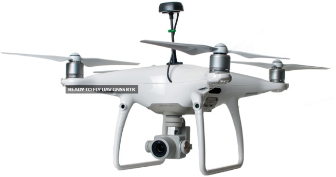
Ready to fly and easy to use DJI drones with additionally installed GNSS receiver connected with modified and calibrated camera, everything you need to get high accuracy photogrammetry data up to 3cm accuracy in XYZ.
Built in survey grade GPS/QZSS, GLONASS, BeiDou, Galileo, SBAS, with possibility to work in RTK and PPK mode turns your drone to professional survey tool.
You can capture aerial photos with up to 1 cm resolution per pixel and easily transform them into high accurate orthomosaic and 3D models in automatic mode.
Advanced obstacle avoidance systems by DJI provides flight safety and simplifies the control of the drone.
Our solution don’t need to use any external power bank etc.
You no longer have to lay down GCPs or just minimize their number, saving countless hours and labor costs.
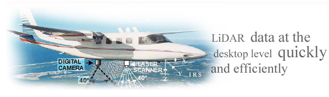
Extending the Value of LiDAR Data throughout the Enterprise
Matrixgeo’s LiDAR-M is a stand-alone light detection and ranging data processing software built on Microsoft .NET technology. LiDAR-M is designed specifically for Photogrammetry and GIS professionals to display, view, edit and process LiDAR data at the desktop level, quickly and efficiently.
Features and Benefits of LiDAR-M:
- LiDAR-M does not depend on any base software like Microstation, AutoCAD, Socet-set, etc.
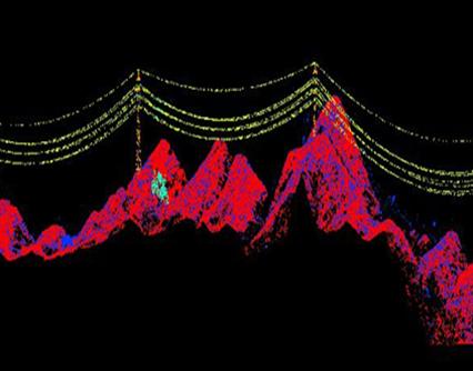
- LiDAR-M can observe cloud points accurately in different cross-sectional views
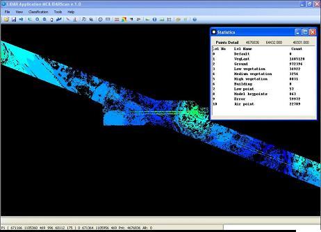
- LiDAR-M classifies data points automatically and manually into various categories, such as ground, vegetation, buildings, etc.
- LiDAR-M delivers data files in multiple input/output formats that include ASCII, TerraScan Bin, ASPRS LAS, and DXF
- LiDAR-M is a cost-effective solution as the mapping supportive functionalities of CAD software are built into the interface
Matrixgeo’s in-house LiDAR classification software