

















Railways & Metro Sector
Smart solutions for planning, construction, and infrastructure management efficiency.

Roads and Highways Sector
Smart solutions for planning, construction, and infrastructure management efficiency.

Mining Oil & GAS
Comprehensive solutions for greenfield development and brownfield project optimization.

Archaeology & Heritage
Solutions for Researches, Explorations, Excavations, Protection, Conservation, Preservation, Tourism / Promotion

Water & Agriculture
Solutions for efficient planning and management of rivers, dams, irrigation, and drinking water resources.

Cities & Rural
Innovative solutions for mapping existing areas and planning a sustainable future.

Power
Tech Solutions from Generation to Transmission for Hydro, Solar, Thermal, and Wind energy for planning, and efficient management.

Training
DGCA Certified Training for government officials, professionals, and freshers, equipping them with geospatial tech skills.

Mapping the Future of High-Speed Rail
How Geospatial Technology Shaped India's First Bullet Train Project Download Pdf
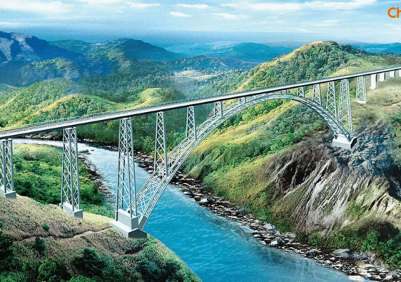
World’s Highest Railway Bridge – Chenab Bridge
Drone-Based Monitoring of the World’s Highest Railway Bridge Download Pdf
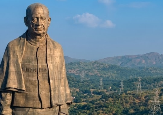
The Statue of Unity
Drone Solutions for Infrastructure Development Around Tallest Statue - The Statue of Unity Download Pdf


Coverage of Matrix Geo Wins MP Govt Contract for Narmada Parikrama Survey, to Deploy Drone Mapping and Digital Twin Technologies of The Economic Times Manufacturing
The Economic Times Manufacturing is a niche B2B platform focused on industrial technology, and policy trends. With around 82,799 monthly views, it delivers targeted reach among industry professionals, decision-makers, and stakeholders across India’s manufacturing and infrastructure ecosystem.

Coverage of Matrix Geo Solutions Secures North Western Railway Contract in The Economic Times Infra
ET Infra, part of The Economic Times, is a leading digital platform focused on infrastructure, construction, and policy news. With 128,048,910 monthly page views and a global rank of #246, it delivers industry insights, expert opinions, and updates on India’s fast-evolving infrastructure sector.

Designing enterprise AI systems that stay fair
In a recent conversation, Amit Sharma, Founder & Whole Time Director, Matrix Geo Solutions, laid out how exclusion does not usually show up in flashy dashboards or broken user interfaces. It surfaces quietly, deep inside data pipelines and logic layers, where feature choices, model assumptions, and training datasets reflect only a narrow slice of reality.


