Transforming Geospatial Data Collection with Advanced Remote Sensing
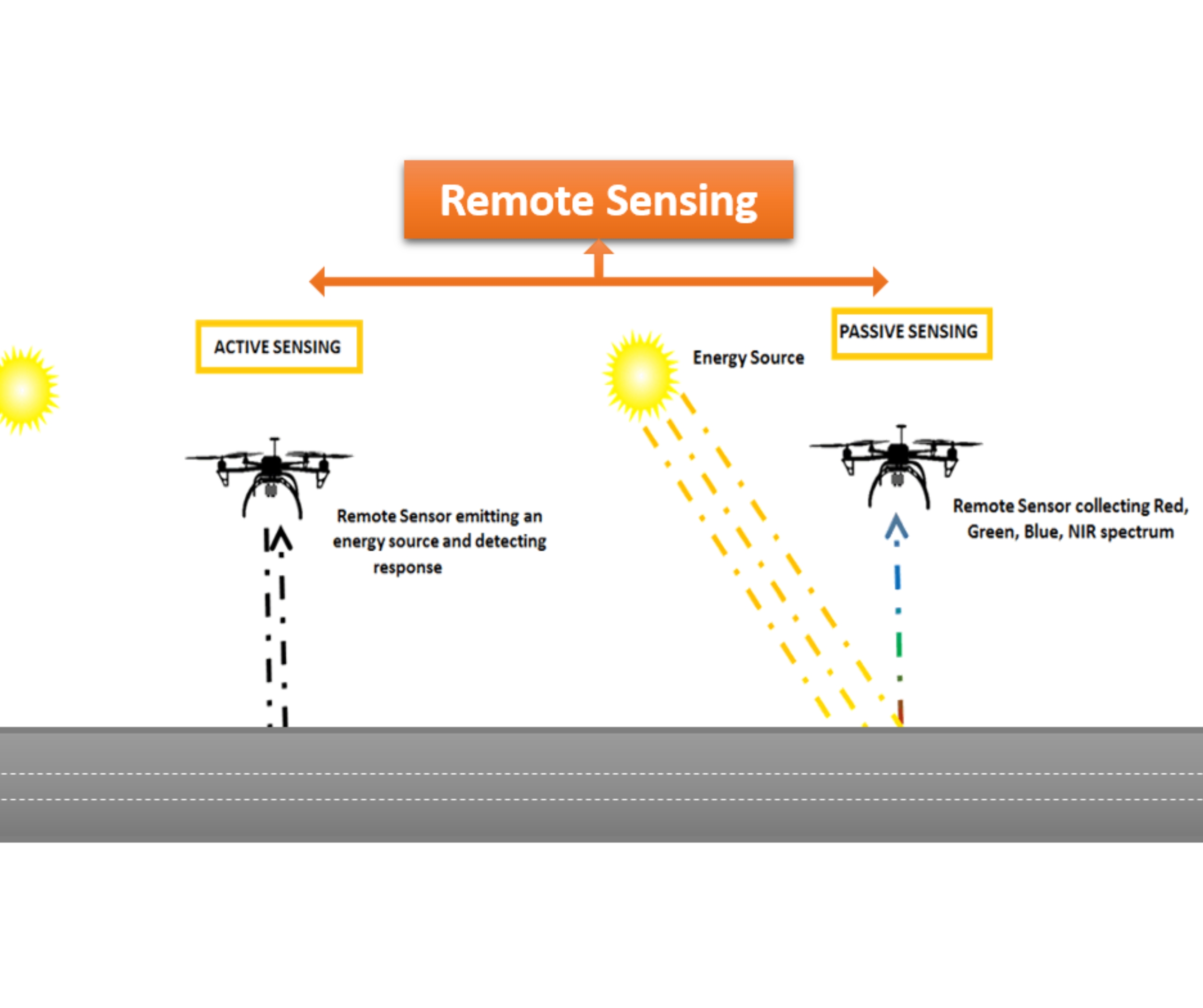
Drone Based Remote Sensing Survey
At Matrix Geo, we utilize state-of-the-art remote sensing technologies, including thermal, infrared (IR), multispectral, and magnetic sensors, to deliver high-accuracy aerial surveys across various industries. Integrated with UAV-based solutions, our technology enables rapid, cost-effective, and precise data collection, significantly reducing the time and labor associated with traditional ground surveys.
These datasets are invaluable for mining exploration, agricultural assessments, and urban planning, providing detailed geospatial insights for accurate analysis and decision-making.


Send Us mail
Why Choose Drone-Based Remote Sensing Surveys?

Technology in Drone-Based Remote Sensing


Our Drone Survey Capabilities
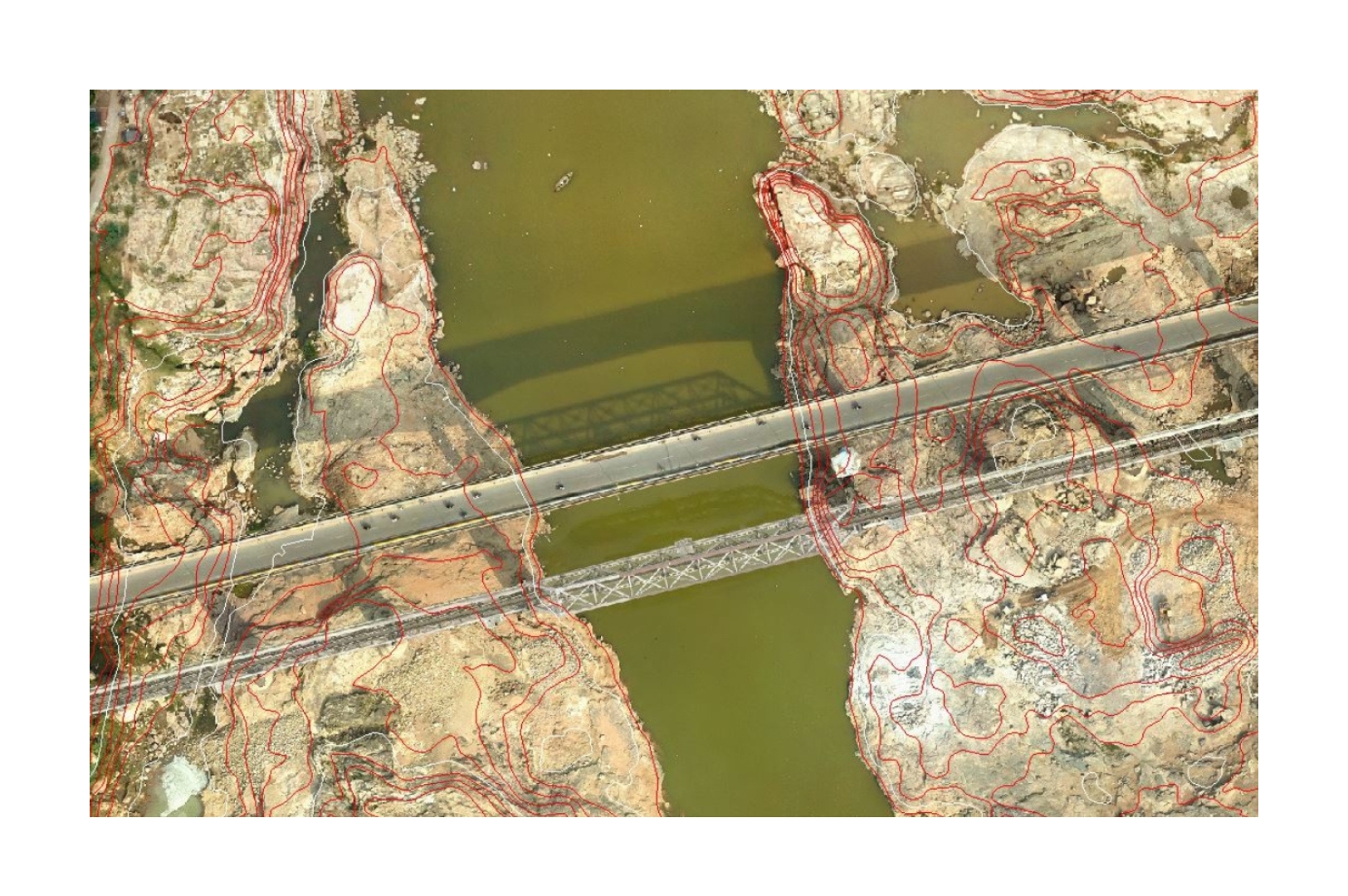
1. Aerial LiDAR Topographic Survey
Our drones equipped with advanced magnetic sensors enable precise detection of underground anomalies, aiding industries in geological mapping, mineral exploration, and archaeological surveys.
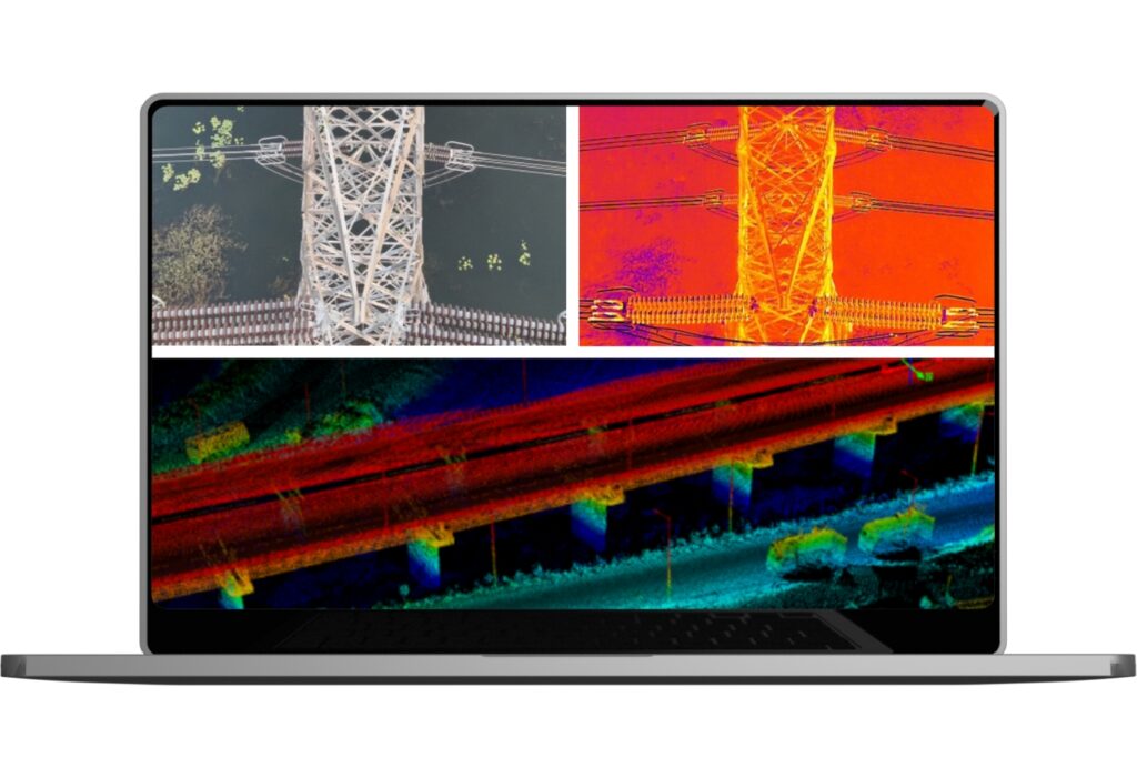
2. Powerline & Utility Monitoring & Inspection

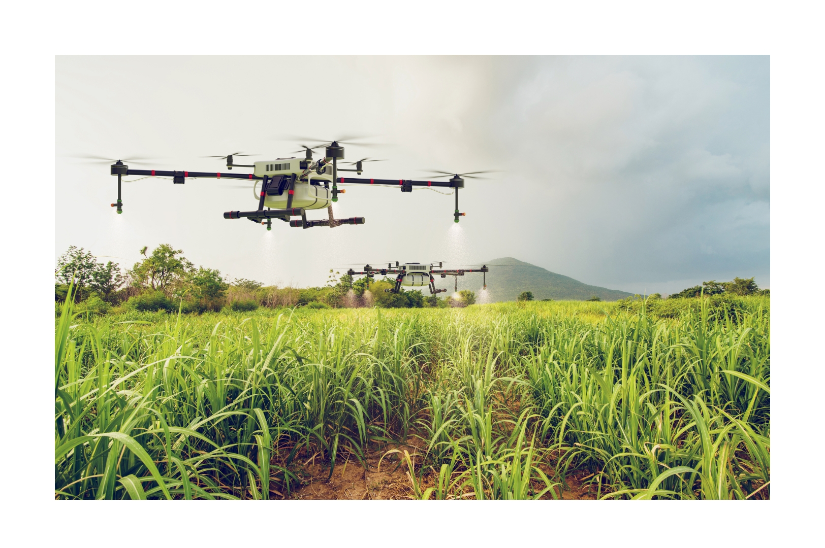
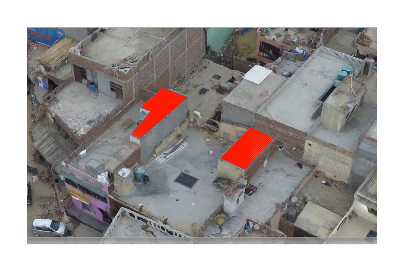
3. Agriculture & Plantation Survey
Our NDVI and multispectral drone surveys help assess crop health, irrigation efficiency, and yield optimization for precision agriculture.
4. Magnetic Sensor Drones for Subsurface Exploration
Our drones equipped with advanced magnetic sensors enable precise detection of underground anomalies, aiding industries in geological mapping, mineral exploration, and archaeological surveys.