High-Precision Subsurface Mapping for Infrastructure & Utilities
GPR SURVEYS
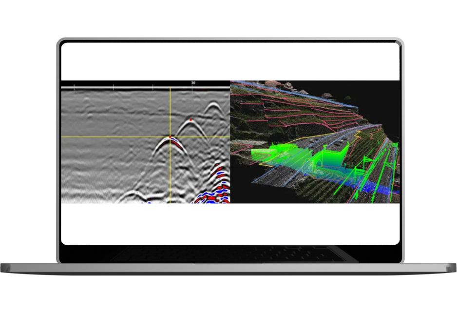
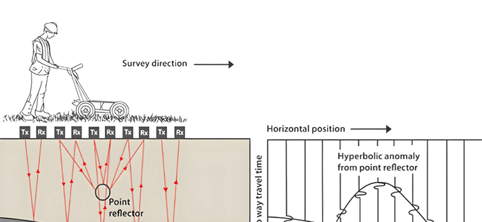
Provides precise Ground Penetrating Radar surveys to detect underground utilities and structures, enabling safer planning and risk assessment with minimal disruption.Service Video
Faster - Smarter - Accurate
Why Choose GPR Surveys?
01
Non-Destructive & Safe
Detect subsurface features without excavation
02
High-Resolution 3D Imaging
Generate precise underground maps for better planning
03
Multi-Depth Analysis
Scan several meters below ground based on terrain conditions
04
Real-Time Results
Get instant data and detect anomalies for quick action
For sustainable infrastructure development, we provide critical support in assessing underground utilities before planning projects such as new roads, road widening, railways, and urban infrastructure development. Our solutions enable precise planning, minimizing disruptions and ensuring efficient project execution.
Infrastructure planning to surveillance and safety, our technology enhances efficiency, supports smart decisions, and drives innovation across the rail network.
Oritech – IT Solutions & Services WordPress Theme is a modern theme, designed for companies providing IT services and technology solutions. With a professional interface, powerful features, WooCommerce integration, and SEO optimization, Oritech helps businesses build impressive and easily customizable websites.


")