Aerial Photography
Matrix-Geo provides aerial photography and data collection from the air through sensors for more than 10 years. Aerial photographs are acquired by Matrix-Geo planes, and drones which are equipped with state of the art mapping cameras. Matrix-Geo currently performs aerial photography in color, in black & white and in infrared.
Aerial photographs are taken from aerial camera mounted on drones, airplane or helicopter. The cameras which we use for photogrammetric applications are called Metric camera.
These cameras provide pictures of the terrain which are used for making precise measurements and other information which help in determining the relative location of the points. It also help in calculating angles, volumes, elevations, size and shape of the object.
Vertical Aerial Photographs
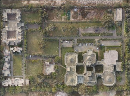
Aerial photographs perpendicular to the ground performed in mapping cameras at different resolutions and heights for orthophoto and photogrammetric mapping.
The database includes wide areas in a stereoscopic overlap for mapping and orthophoto, as well as photographs in different overlaps for the purpose of comparative analysis for a variety of purposes.
Oblique Aerial Photography
Aerial photographs in varying angles (determined by the nature of the project) are performed by a variety of cameras in different parameters for the purpose of 3D modeling and for the artistic documentation of landscapes and sites.
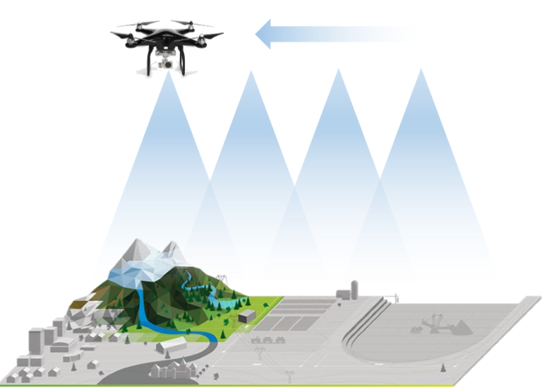
Drone based Low Altitude Aerial Photography
- Advance Drone Imagery from Very High Resolution Camera (Camera Type)
- RGB, Infrared (IR), Thermal, Multispectral
- Resolution upto 1 CM
Manned Aircraft based Aerial Photogrammetry