Archaeology & Heritage
Our world class technologies and best practices help archaeologist in excavation, conservation, restoration, documentation by using modern survey technologies to collect accurate information, perform analysis and help in taking quick and reliable decision.
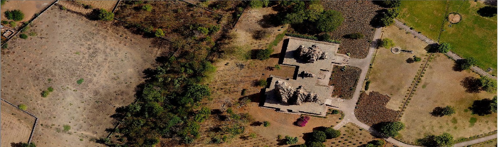
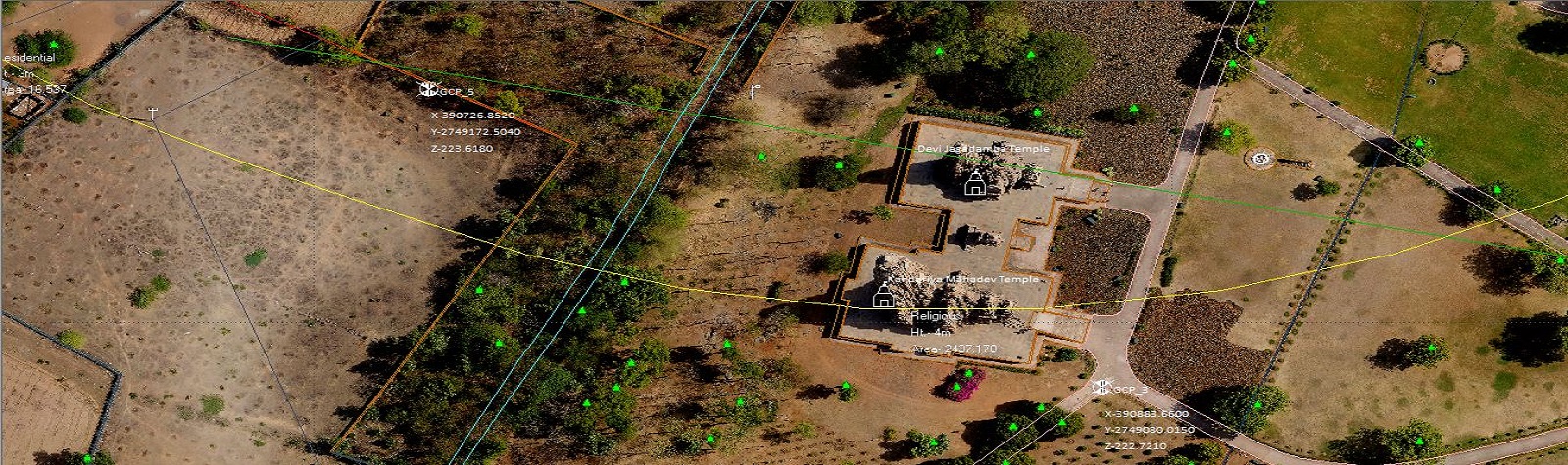
Drone, Terrestrial and Close Range Photogrammetry
Photogrammetry is a marvel technique to survey a monument site or a building remotely. Using this technology we can develop the detailed drawings and measurements of the structure.
Matrix-Geo has carried out various projects for Photogrammetry surveys using metric and amateur cameras. Matrix-Geo provides following services
- Drone Based Aerial topographical Survey of archaeological sites
- Terrestrial photography acquisition
- 3D restitution of buildings and Monuments
- Architectural mapping and analysis
- Facade mapping
- 3D Projection Mapping
LiDAR Survey
We use our Terrestrial Laser Scanner for Indoor & outdoor survey of an Archaeological site for precise documentation of structures and other items found during excavation.
Under Ground Survey (GPR)
We use our Ground Penetrating Radar Scanner to carry out under ground survey of an Archaeological site for precise documentation and help in the excavation.
")
Project Highlights
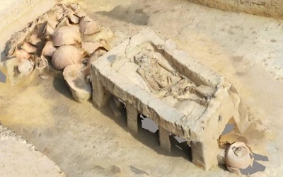
Drone Topographical survey of Excavation Site at Sinoli and 3D model of a 4000 years old human fossil
Terrestrial Photogrammetry Survey of Mumtaz Mahal, Red Fort, New Delhi
Drone Based Aerial Survey and 3D Modelling of Jain Temples in Palitana Hills, Gujarat
Aerial Photogrammetric Survey of 12+ Centrally protected monuments to find Encroachments