Harness the Power of Geospatial Technology for Smarter Decisions
GEOSPATIAL SERVICES
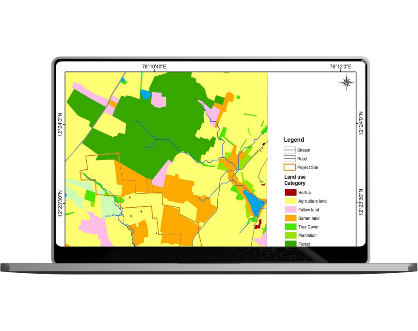
We provide geospatial consulting through GIS, remote sensing, AI, and aerial surveys, helping businesses and governments boost efficiency, cut costs, and make smarter decisions.Service Video
Data Processing & Geospatial Solutions
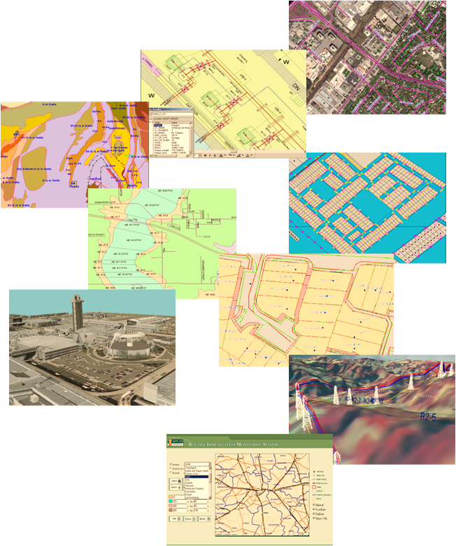
We specialize in transforming raw spatial data into powerful analytical assets through our complete suite of geospatial services.
Complete geospatial support, from data capture to decision-ready insights.
02
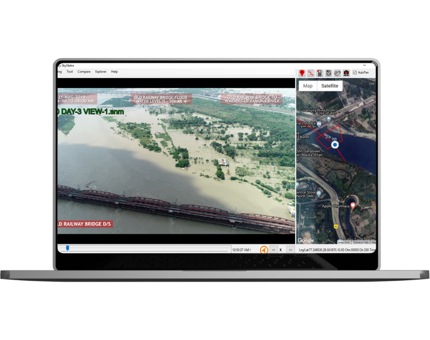
AI-Driven Insights
Smarter predictions and optimizations with AI-powered analytics.
03
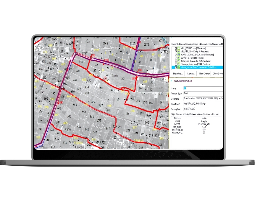
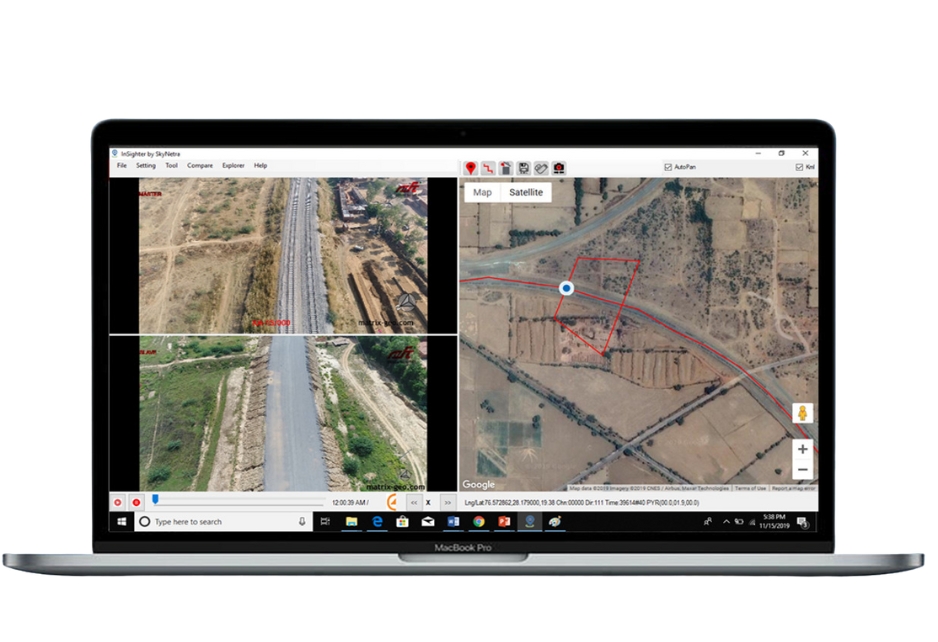
Cloud Collaboration
Real-time project tracking for infrastructure, railways, and utilities.
04
Cost-Effective Platform
Eliminate costly software with our web-based geospatial solution
SECTOR WE SERVE
Where we use this Technology
Infrastructure planning, surveillance, and safety, our technology enhances efficiency, supports smart decisions, and drives innovation across the rail network.
Oritech – IT Solutions & Services WordPress Theme is a modern theme, designed for companies providing IT services and technology solutions. With a professional interface, powerful features, WooCommerce integration, and SEO optimization, Oritech helps businesses build impressive and easily customizable websites.


")