

")


")
")


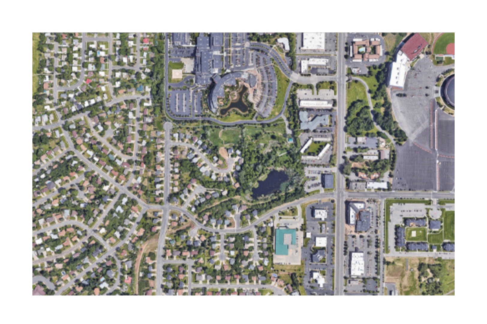
Orthophoto
Ultra-high-res orthophotos (1–10 cm) offer precise ground insights for planning and analysis.
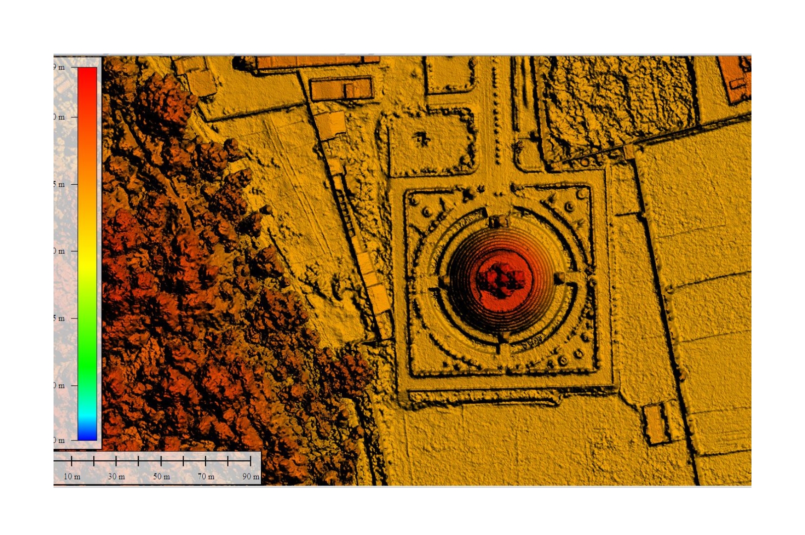
Digital Terrain Model (DTM)
3D bare-earth models from drones/LiDAR offer cm-level data for volume, slope & terrain analysis.
Digital Surface Model (DSM)
3D surface models with all features aid terrain, utility, and vegetation analysis using drones/LiDAR.
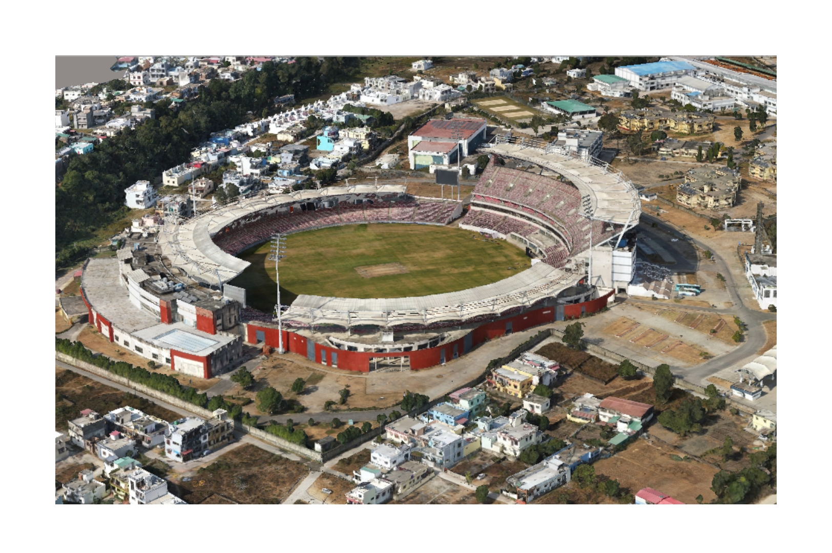
3D Reality Model
Digital twins from drone images offer accurate 3D views for planning in real estate & construction.
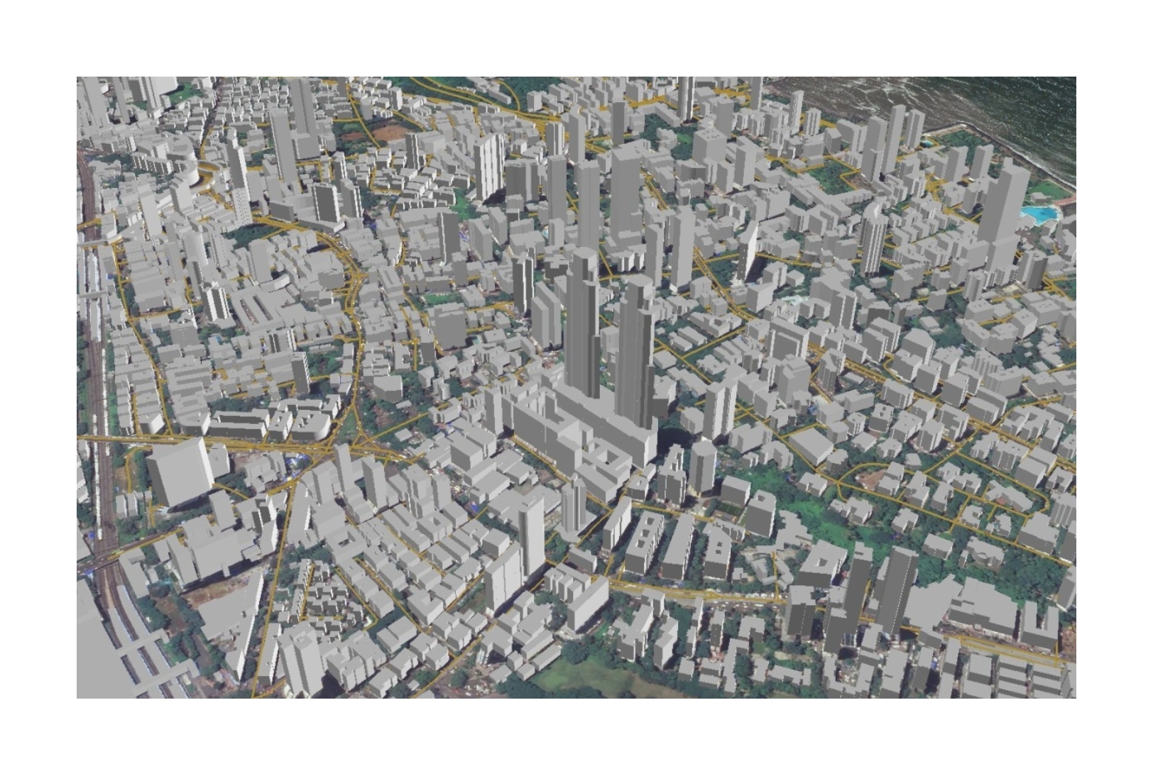
Precise 3D Maps
Drone-based 3D maps deliver CAD-accurate data for infra, construction, and terrain analysis.
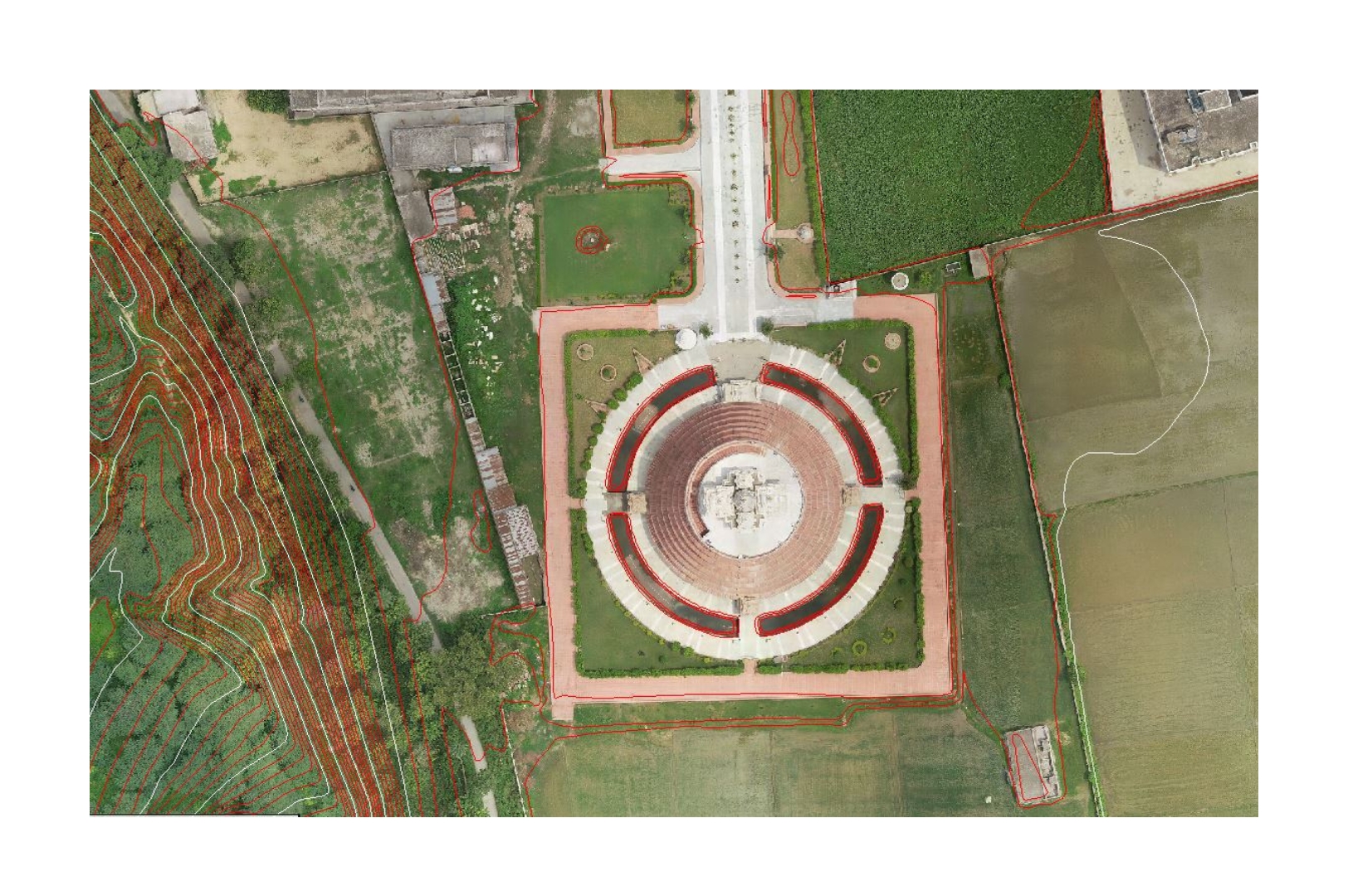
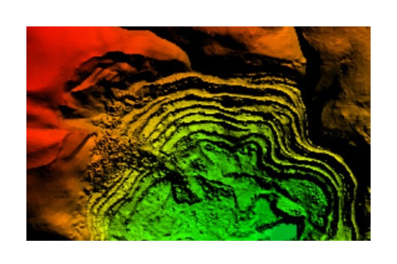
Contours
Drone-based contour maps show elevation & slope for precise planning in infra, agri & land use.
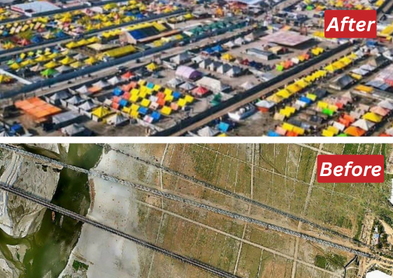
Maha Kumbh Event Planning
Drone-based pre- and post-monsoon surveys for Maha Kumbh planning with UP Government. Download Pdf

Char Dham Railway Connectivity
Integrated satellite and DGPS-enabled drones for Himalayan terrain with RVNL. Download Pdf
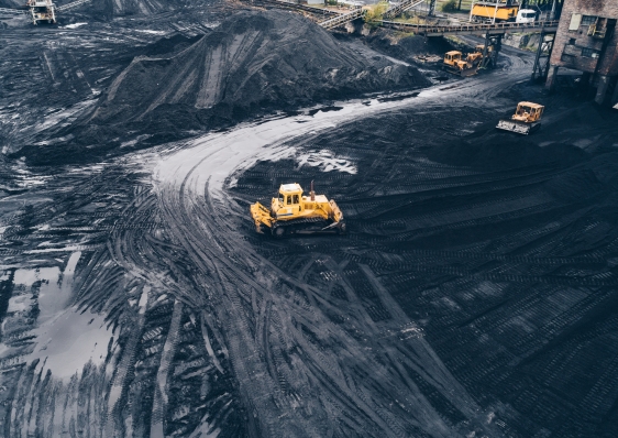
Drone LiDAR Survey for Adani
Drone based LIDAR survey for Gondakhari Coal Block Maharastra Download Pdf