Cities & Rural
- Home 01
- Cities & Rural
Technology
Have Any Questions?
+91-7531007100

Send Us mail
MatrixGEO offers a range of Technology services for all firms all over the industry
Smart Solutions for Smarter Cities & Sustainable Rural Development
Matrix Geo leverages cutting-edge geospatial technologies to transform urban and rural landscapes. From smart city planning to rural development, our data-driven solutions enhance infrastructure, optimize resources, and drive sustainable growth.
Urban Solutions for Smart Cities

Rural Development Solutions

EXPLORE OUR PROJECT
Project Highlights
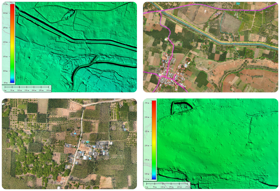
100,000+ Ha & 1,500+ Villages Surveyed
Drone-based mapping for the Swamitva Scheme across Uttar Pradesh, Gujarat, and Delhi.
Learn more

150,000 Ha Rural Mapping Initiative
Extensive drone-based land survey for Andhra Pradesh SSLR.
Learn more

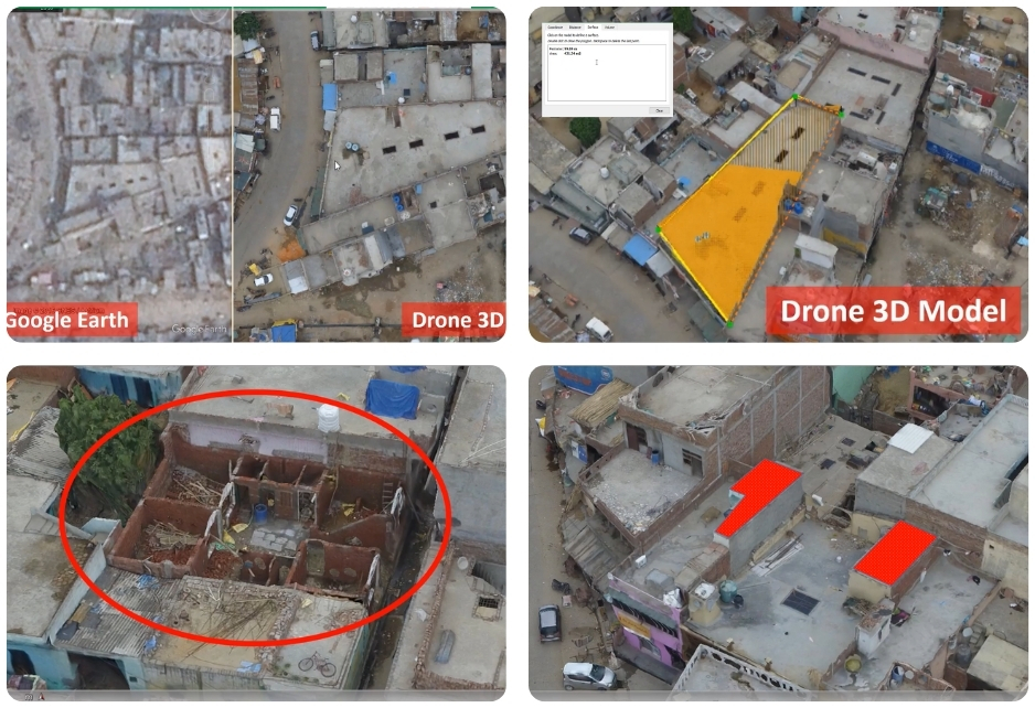
80,000+ Ha Urban Mapping
AMRUT 2.0 project covering Jabalpur (MP), Raipur (Chhattisgarh), and various cities in Uttar Pradesh.
Learn more
