Transforming Satellite Imagery into Actionable Intelligence for Larger Areas
Satellite-Based Geospatial & Remote Sensing Consultancy
At Matrix Geo, we specialize in leveraging high-resolution satellite imagery and advanced remote sensing techniques to provide highly accurate geospatial datasets for multiple industries. Our expertise in photogrammetry, digital elevation modeling, and orthophoto generation helps clients make informed decisions based on precise, large-scale spatial data.
With access to the latest satellite constellations and state-of-the-art processing tools, we deliver cost-effective and high-quality mapping solutions tailored to various applications, including urban planning, infrastructure development, environmental monitoring, and disaster management.

Why Choose Satellite-Based Solutions?

Our Satellite Data Processing Capabilities

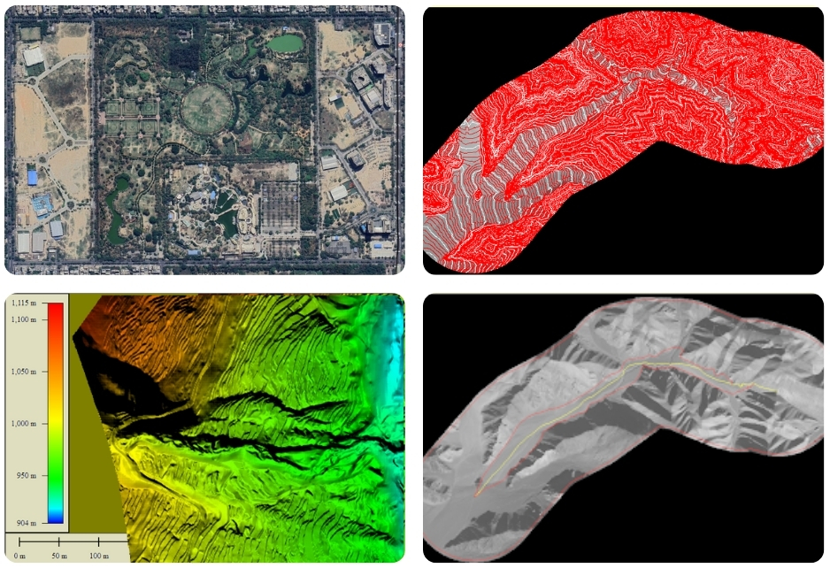
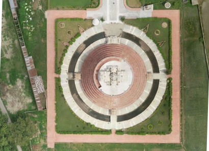
3D Topographical Mapping
High-precision 3D vector maps support planning, flood analysis & land-use management.

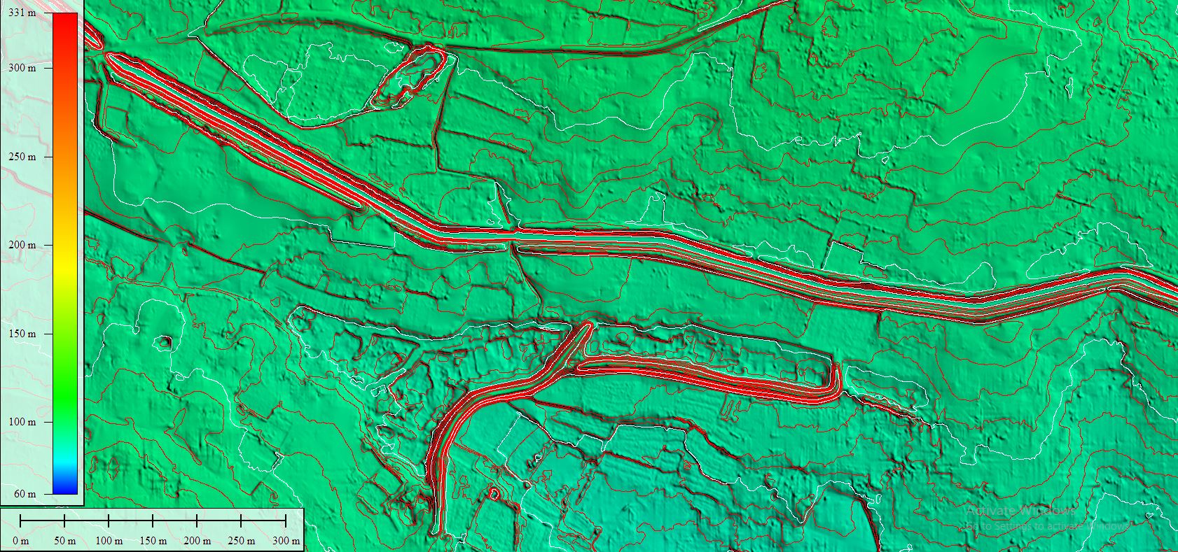
Digital Elevation Models (DEM/DTM/DSM)
DEMs, DTMs & DSMs support slope, watershed & terrain analysis for mapping & disaster planning.

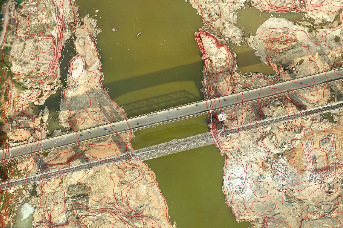
Orthophoto Generation
We deliver distortion-free orthophotos, Conventional, True, and RGB, for precise mapping needs.

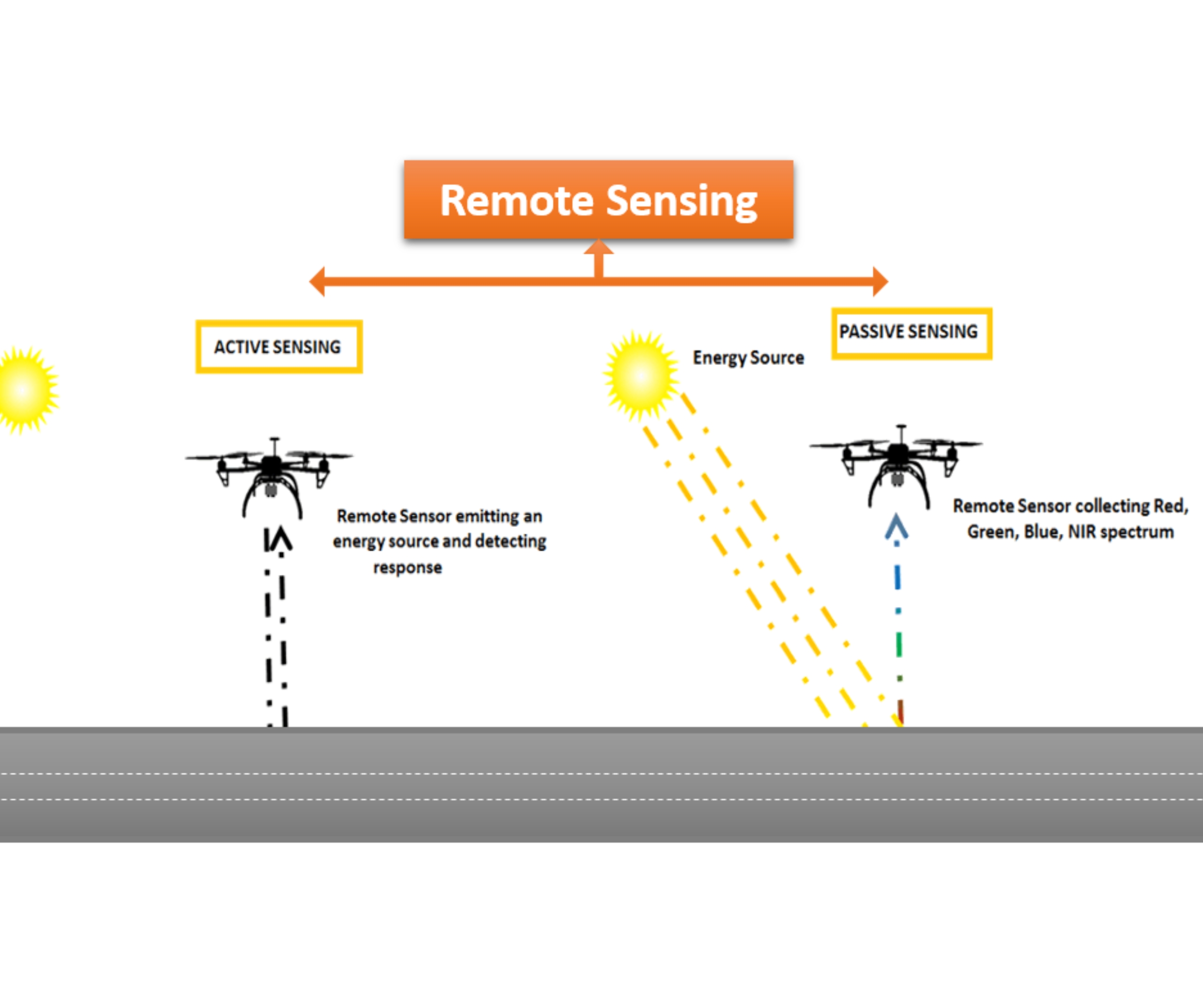
Remote Sensing Analysis
Extract insights from satellite data via spectral analysis for land cover, crops & disaster impact.
Industry-Leading Software & Expertise
At Matrix Geo, we provide high-precision drone-based inspection services, enabling safer, faster, and more cost-effective assessments of critical infrastructure. Our drones, thermal imaging, and LiDAR technology deliver real-time insights, helping industries optimize maintenance, detect anomalies, and prevent failures before they escalate.
Where we use this Technology
Infrastructure planning to surveillance and safety, our technology enhances efficiency, supports smart decisions, and drives innovation across the rail network.